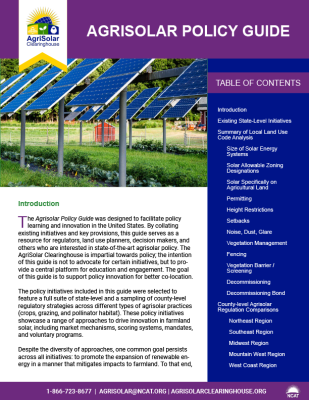
Agrisolar Policy Guide
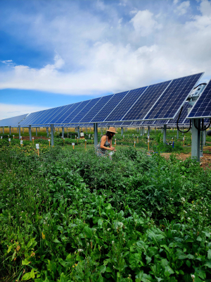
Photo: NCAT
Contents
Existing State-Level Initiatives
County-level Agrisolar Regulation Comparisons
Summary of Local Land Use Code Analysis
Solar Allowable Zoning Designations
Solar Specifically on Agricultural Land
Vegetation Barrier / Screening
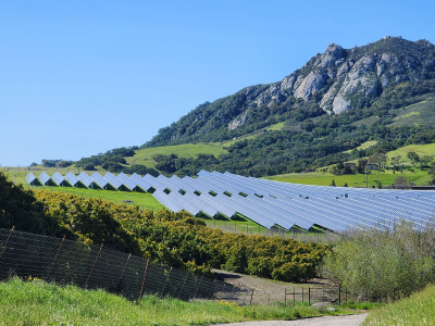
Photo: NCAT
Introduction
The Agrisolar Policy Guide was designed to facilitate policy learning and innovation in the United States. By collating existing initiatives and key provisions, this guide serves as a resource for regulators, land use planners, decision makers, and others who are interested in state-of-the-art agrisolar policy. The AgriSolar Clearinghouse is impartial towards policy; the intention of this guide is not to advocate for certain initiatives, but to provide a central platform for education and engagement. The goal of this guide is to support policy innovation for better co-location.
The policy initiatives included in this guide were selected to feature a full suite of state-level and a sampling of county-level regulatory strategies across different types of agrisolar practices (crops, grazing, and pollinator habitat). These policy initiatives showcase a range of approaches to drive innovation in farmland solar, including market mechanisms, scoring systems, mandates, and voluntary programs.
Despite the diversity of approaches, one common goal persists across all initiatives: to promote the expansion of renewable energy in a manner that mitigates impacts to farmland. To that end, these initiatives are led by both state energy and agriculture agencies, which demonstrates the cross-sector collaboration needed to effectively manage agrisolar. Key themes across initiatives include sustained growth of solar, prioritization of agricultural activity, maintenance of performance standards, and land stewardship.
While the policy approaches are diverse, the geographic representation is not. There is an evident cluster of state-level agrisolar policy initiatives in the Midwest and Northeast U.S. This lack of geographic representation is not the result of sampling method, but a reflection of the current state of affairs. This guide presents five existing state-level initiatives as of March 2023 and is intended to be regularly updated as funding and capacity allow.
The included policies are not exhaustive. Many local initiatives and tools exist, which can be reviewed in the Policy Approaches for Dual-Use and Agrisolar Practices.
Although not included in this guide, other key considerations related to agrisolar policy may be useful for users. First, the absence or presence of policy can provide a strong signal to industry actors. Second, how agrisolar is legally defined, including how inclusive or exclusive the definition is of the various types of co-location, is important. Other key considerations include but are not limited to: the relevant electric utility, interconnection, system scale, community solar, net metering, farmer/landowner agreements, ownership models, and distinctions between on-farm and off-farm energy use.
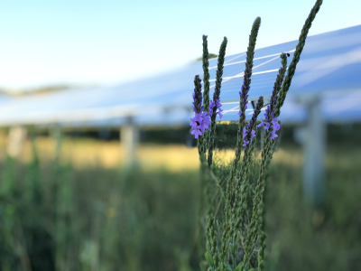
Photo: NCAT
Existing State-level Initiatives
For examples of existing state-level initiatives and county-level agrisolar regulation comparisons, visit the links below:
Illinois
Massachusetts
Michigan
Minnesota
New York
County-level Agrisolar Regulation Comparisons
Northeast Region
Southeast Region
Midwest Region
Mountain West Region
West Coast Region
Photo: NCAT
Summary of Local Land-Use Code Analysis
Size of Solar Energy Systems
Solar energy systems are typically separated into small, medium, and large systems. Small ranges from 2.5 to about 10 acres. Large is anywhere from 10 to 320 acres, with most being 20 to 40 acres. More permissive counties don’t have any written maximum size.
Solar Allowable Zoning Designations
Solar energy systems are allowed in almost all zoning, to a degree, with more issues to be addressed in residential, agricultural, and commercial areas.
Solar Specifically on Agricultural Lands
Mainly, the regulations pertain to avoiding “prime farmland” with special permitting discretions. Both the West and East coasts have some recognition of dual-use allowances.
Permitting
Acreage, MW size, and zoning overlay all play a part in the level of scrutiny a solar project receives during the permitting stage.
Applications have a varying degree of scrutiny. Topics typically addressed include:
Address and contact information
Maps with topography (contours), political, and property boundary delineations
Project drawings/site plans – depicting easements, right of ways, fenced areas, equipment locations, distance to roads and property boundaries
Photo: NCAT
Drainage/flooding/stormwater management plan and mapping
Interconnection agreement and electrical design
Traffic plan – driveways, loading/unloading, construction vehicle impacts, parking
Environmental mitigations: dust, weeds, soils, biodiversity reviews, buffer strips, screening
Economic impact plan – including taxes
Visual impact
Impact of local airports/air traffic
Police review
Waste management
Application fees
Decommissioning/reclamation plans
Height Restrictions
Maximum heights range from 12 to 45 feet. Most fall between 15 and 25 feet.
Setbacks
Setbacks range from 25 to 500 feet (average 100 to 300 feet) depending on the size of system, neighboring parcels being residential or occupied, and which side is deemed to be front.
Noise, Dust, Glare
Some localities do not address glare at all, while others seem to be sensitive to glare for public right-of-ways and planes traveling over. Most localities do not address noise in their solar ordinances. Several areas set limits of 50 to 60 decibel limit at boundary line. About half of the localities require a dust and/or erosion plan, while others have no such requirements.
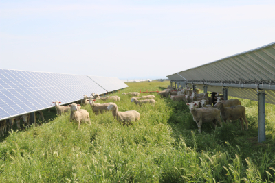
Photo: NCAT
Vegetation Management
Almost all localities required a plan to protect soil during construction with revegetation after construction. Some plans require specific types of plantings and how the plants will be cared for (no chemical fertilization or herbicide/pesticides application).
Fencing
Almost all localities require a 6- to 8-foot-tall fence with required signage. Some provide detailed descriptions of the type of fencing necessary.
Vegetation Barrier/Screening
Almost all localities require screening the solar array and creating a visual buffer with vegetation or wildlife-friendly fencing. Sometimes it is only required if adjacent properties are residential, public right-of-ways, or sensitive areas. Some specify that native vegetation, evergreens, or shrubs of specified heights and distances from boundaries should be used.
Decommissioning
All localities require some level of decommissioning information. Plans were required to address site reclamation, revegetation (exclusion of noxious weeds), disposal of solar energy equipment and construction materials (including hazardous materials), the timeframe for decommissioning to start (typically within 12 months after energy production ends), and the proposed work schedule for decommissioning. Additional requirements for some localities include:
Costs of decommissioning (including salvage) to be updated every five years in detail
High degree of detail on means for decommissioning certified by a professional engineer
Decommissioning Bond
Depending on the location, some areas do not require a bond and others have a three- or five-year bond, which is renewed every three or five years. Additional requirements for some localities include:
Bond, irrevocable standby letter of credit, or other form of security for the amount requisite for decommissioning a site appropriately
Security deposit into government escrow
Some added 20 to 50% of the declared commissioning sum as contingency funds
Photo: NCAT
Agrisolar Policy Guide
By Allison Jackson, Colorado Agrivoltaic Learning Center, and Alexis Pascaris, Agrisolar Consulting
Published April 2023
This publication is produced by the National Center for Appropriate Technology through the AgriSolar Clearinghouse, based upon work supported by the U.S. Department of Energy’s Office of Energy Efficiency and Renewable Energy (EERE) under the Solar Energy Technologies Office Award Number DE-EE0009372.
