Written for the AgriSolar Clearinghouse by Center for Rural Affairs
Tag Archive for: Solar Apiary
Written for the AgriSolar Clearinghouse by Center for Rural Affairs

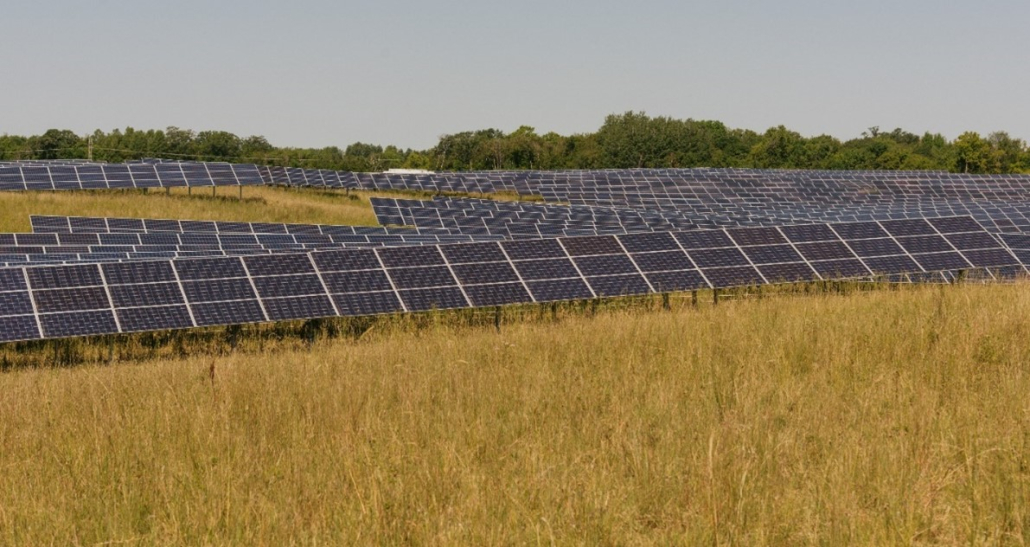
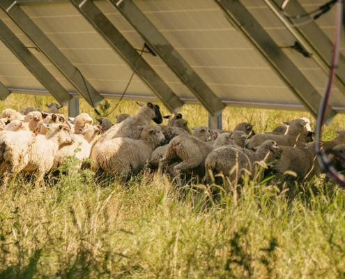
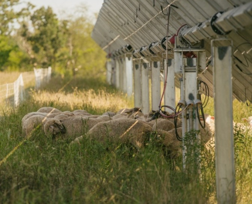
Lake Pulaski is an agrivoltaic solar power plant site developed by Enel Green Power that spans over 68.2 acres in Buffalo, Minnesota. This site is one of 16 developed for the Aurora Distributed Solar LLC project in 2017, supporting pollinators, grazing, and an apiary. The layout consists of 34,668 panels at 315 watts each, spanning over 500 individual arrays. The total plant system size is 10.92MW (dc). Each panel has a SolTech single, horizontal axis tracker to follow the sun path and optimize production. This tracker was chosen over the more standard axis-pole trackers due to their ability to allow curves in the array installation to accommodate the rolling landscape. The developers strived to install the system with minimal land disturbance to maintain the landscape and reduce excavation, thus allowing the panels to move with the rolling hills. Panel height was design to be approximately 2.5 fee from the ground at the maximum tilt angle of 45o to allow grazing sheep to pass under without harm to sheep or panels. This sets the total height of each array at a maximum of 10 feet.


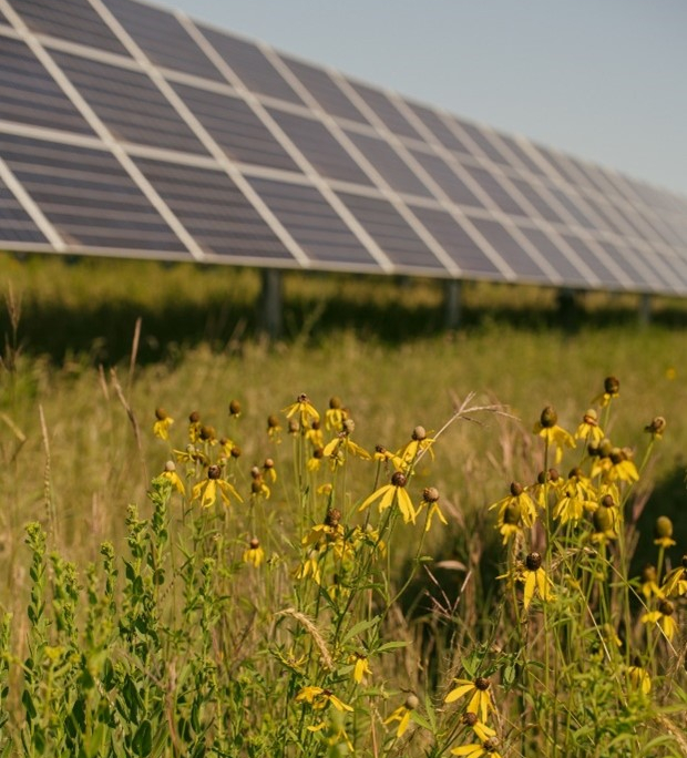
The landscape is grazed once a year near the end of September for one month to reduce the need for mowing, save on labor and gas, and maintain a healthy soil chemistry. Graduate students at Temple University in Pennsylvania are conducting studies on the benefits of grazing, such as soil composition, a reduced mowing, and a reduction in spraying for weeds. Eight of the 16 Aurora project sites are grazed for research purposes. Occasional mowing is required if the area has a high-growth year. Minnesota Native Landscapes (MNL) developed the original native seed profile to help promote pollinator activity under the panels. The final seeding was completed by Westwood Professional Services. MNL also maintains the pollinator and native landscape. Bare-grounded spraying is used to kill off unwanted invasive species, such as thistle. These areas are then fenced off to prevent wildlife and sheep in the area. Soil samples are taken from sprayed and mowed areas for research. Lake Pulaski also promotes the bee population by allowing bee farmers to move their hives next to the site to help pollinate the area and grow healthier bees.


Lake Pulaski is not without maintenance needs. The enormity and complexity of the site requires technicians, plant experts, landscapers, and sheep farmers to ensure that the site function as designed. Enel Green Power does most of the technical maintenance, while MNL sprays and maintains the plants. The SolTech trackers require slightly more maintenance than pole trackers, and they can go offline due to storms, sheep knocking the sensors, and other natural causes. Background research is being conducted by ENEL to determine whether the tracking system is worth the extra maintenance. At the end of the site’s service life, which is typically 25 years, the developers hope to decommission the system and return the land to agriculture with richer soil than the gravel alternative and unharmed adjacent landscapes. The research from this site will help quantify the benefits that agrivoltaics can bring to both solar development and agriculture industries.
By Briana Kerber, Fresh Energy
Developer: Pine Gate Renewables
Location: Medford, Oregon
Size: 13 MW, 41 acres (scorecard)
Soil type: Clay
Annual precipitation: 49 inches
Ground cover: A diverse pollinator seed mix of more than 30 types of native wildflowers and grasses
Funded by the U.S. Department of Energy’s (DOE) Solar Energy Technology office, the Photovoltaic Stormwater Management Research and Testing (PV-SMaRT) project from Great Plains Institute, DOE’s National Renewable Energy Laboratory, Fresh Energy, and the University of Minnesota is using five existing ground-mounted photovoltaic (PV) solar sites across the United States to study stormwater infiltration and runoff at solar farms. Together, the five sites represent a range of elevations, slopes, soil types, and geographical locations that will help solar developers and owners, utility companies, communities, and clean energy and climate advocates better understand how best to support solar projects and the host communities in which they are built, in particular lowering the costs of clean energy development while ensuring protection of the host community’s surface and ground waters.

Site Background
Situated on 41 acres of agricultural land that previously had a rich, long tradition of dairy grazing, the 13-megawatt (MW) Eagle Point Solar project owned by Pine Gate Renewables is part of the company’s SolarCulture Initiative, which promotes sustainable agriculture, collaboration with communities, and research for intelligent solar development. In the early morning—and again in the late evening—the panels at this site sit about one meter above the ground, rotating to three meters above the ground at midday. This allows mowing equipment to pass through when the site needs maintenance, an essential aspect of maintaining quality habitat at solar sites.
After determining that experienced landscapers would be able to restore and maintain the groundcover, Pine Gate decided to make Eagle Point one of the first projects for the SolarCulture program. A flat site with clay soil and 16 inches of annual rainfall, this site’s PV-SMaRT monitoring equipment was installed in August of 2020 and will be in operation through August of 2022.

Pine Gate hired landscape design consultant Regenerate to come up with a vegetation plan, and Understory Consulting, an ecological consulting and restoration service nonprofit operating in Oregon and northern California, was chosen to develop a multi-year plan to seed the site with native flowers and grasses tucked underneath the site’s tracking photovoltaic (PV) panels in two-in-portrait configuration. The seed mix was developed by Sean and Kathryn Prive, who Maggie Graham, a researcher with Oregon State University and ecologist at Understory, describes as the “dreamers behind the project who led the restoration at the site.” The multi-year plan developed by the Prives is intended to restore the understory of the solar site to a native prairie and support native and domesticated pollinators.
Remarking on the site’s dual uses, Maggie mentions the support the site provides for both pollinator habitat and seed collection for the Rogue Native Plant Partnership. Facilitated by Understory, the Rogue Basin Partnership, and the Medford, Oregon, District Office of the U.S. Department of Interior’s Bureau of Land Management, the Rogue Native Plant Partnership focuses on increasing the diversity and availability of native plant materials in the Rogue Valley, a much-loved valley region in southwestern Oregon known for its wild and scenic Rogue River that runs from Oregon’s famous Crater Lake out to the Pacific Ocean.
When asked about challenges the team has run into at the site, Maggie offers a typical answer: “Weeds.” She adds, “Any time you’re trying to take a piece of land and modify the vegetation, weeds are a challenge.” Drought, too, has introduced some hurdles for the site to clear, as much as Maggie notes that “Drought in the west is ongoing, and normal to a degree.”
Despite the challenges, Maggie says, “It was especially neat to uncover what this site holds that had been obscured by previous vegetation. When we eliminated the weed pressure from a lot of the rhizomatous, introduced grasses—grasses that almost creep and grow quickly across a piece of land—we found a strong native seed bank and bulb bank at the site. This included a field of camas, which is a culturally important plant in the region.”
Additionally, the site boasts co-benefits unique to pollinator-friendly solar farms—honeybee hive hosting, native seed collection, and research, too. “This site in particular has a local beekeeper, John Jacob, on site who has expressed an appreciation for the late season forage that the site provides.” Jacob, owner and founder of Old Sol Apiaries and former president of the Southern Oregon Beekeepers Association, determined that Eagle Point would be an ideal location for his honeybee hives, and an agreement with Pine Gate ensured that Jacob could place a few dozen hives on the perimeter of the farm.
The shade from the site’s solar panels increased the abundance of flowers under the panels and delayed the timing of their bloom, which provides forage later into the season, Maggie says. She adds, “The native seed collection is especially unique—it’s wonderful to have enough seed production at one site to help support other ecological restorations. We’re fortunate to benefit from Pine Gate’s willingness to use this site for repeated research projects. This is one of four that I know is happening at Eagle Point.”

Research Process
As discussed in the first PV-SMaRT case study on Connexus Energy’s Minnesota site, when engineers and researchers sit down to plan out or conduct analyses on clean energy developments like solar farms, they often utilize something called a design storm to test how well the site will hold up against an extreme weather event like a flood. A design storm is a test flood event of a certain magnitude—the higher the magnitude, the more intense the test storm. These tests help researchers and engineers to model and analyze rainfall and soil moisture, as well as to determine how fast excess water soaks into the ground during extreme storms.
Jake Galzki, a researcher with the University of Minnesota who is part of the modeling team for the PV-SMaRT project, says, “The Eagle Point site is the heaviest clay soil in the study, which is generally associated with lower infiltration rates. However, this site has a deeper crop rooting depth than some of the other sites, and Hydrus modeling showed slightly more infiltration than the shallower soils in the study. Approximately half of the 100-year design storm was infiltrated in the model simulations.”
Aaron Hanson, Energy Program Specialist at the University of Minnesota’s Institute on the Environment, says, “A key outcome of this project was to provide clarity on how solar farms and select ground cover impact storm water runoff at large-scale developments. This site is providing key insights to our model that in turn will help the solar industry, state and local governments, and communities understand the impacts and make better decisions.”
Based on the field research and modelling completed on this site and the other four sites across the country—New York, Georgia, Minnesota, and Colorado—the University of Minnesota team has also developed a stormwater runoff calculator. The modeling results from the calculator demonstrate that, under most site conditions, if soils are not compacted and deep-rooted vegetation is established, solar farms result in significant decrease in runoff compared to agricultural land uses. The calculator will be publicly available for use by local and state regulators, solar industry contractors and developers, and water quality advocates. GPI is modifying the interim best practice guide completed last fall to accompany the calculator and reflect the final modeling results.

Project Site Benefits
In the eyes of the project’s core team, the Eagle Point site presents some specific observations on another key aspect of the PV-SMaRT project’s focus: permitting. For reference, the federal government generally delegates administration of stormwater permitting, required under the Clean Water Act, to individual states. While based on a common foundation, state stormwater permitting processes will always reflect each state’s unique ecosystems and water quality priorities; therefore, solar projects must adapt to these differences.
Remarking on that adaptation process at the Eagle Point site, Brian Ross, vice president and project lead at Great Plains Institute says: “The Eagle Point site in Oregon gives us a West Coast example to demonstrate the national implications of the scientific findings, best practices, and final runoff calculator. Each state interprets the Clean Water Act regulations somewhat differently and looking at the Eagle Point site further demonstrates the applicability of the science across different regulatory and permitting regimes.”
Stakeholder Feedback and What’s Next
Like the other PV-SMaRT sites, data and observations from the Eagle Point site now serve as a benchmark as the project’s research team continues to gather insight about each of the five project sites across the country. Ongoing findings at the Eagle Point site further validate the project’s recommended best practices for solar developments and stormwater management: It is possible to help lower the soft costs of clean energy development and of ongoing maintenance, protect the host community’s surface and ground waters, create needed habitat, and sequester carbon in the soil, all while helping craft a sustainable clean energy future that will benefit everyone for generations to come.
Throughout 2022, experts and stakeholders will be reconvening in this process to continue to examine and provide feedback on this foundational research. Read the first PV-SMaRT case study on Connexus Energy’s Minnesota site, the second case study on SolAmerica Energy’s Georgia site, and stay tuned for updates on the project from Great Plains Institute. There will be a webinar talking about each of the three PV-SMaRT case studies this September—we invite you to join us! More details coming soon.
Photos
*Photo credit for all photos: Maggie Graham
